Showing posts with label bicycling. Show all posts

Saturday, September 27, 2014

C&O Canal Bike Ride - Paw Paw to Little Orleans

This weekend I went for an excellent bike ride on the C&O Canal tow path from Paw Paw down to Little Orleans and back.  The weather was excellent - mid 60s and sunny.  Most of the path was under the shade of trees.  It was just under a 2 hour drive from Ashburn out to Paw Paw, WV.  We stopped there at the Liberty Gas station just before the bridge over the Potomac River to use the facilities and get a few bottles of water.  Then we headed across the bridge to park at the camping area parking lot just south of the Paw Paw Tunnel.

The Paw Paw Tunnel was simply amazing.  Digging this tunnel saved them from having to follow 5 miles of winding turns on the Potomac River.  The tunnel was finished in 1850, and I am in awe of the guys who dug this 3,100 foot tunnel with the technology they had back then.  They hand-laid brick through the entire tunnel.  The canal through the tunnel is still full of water, and there is a narrow walkway on the side where the donkeys used to walk, pulling the barges alongside them. 

The trail is a little bumpy and had puddles in spots.  Plus it was absolutely pitch black in the middle of the tunnel and the headlight on my bike didn't reach very far in front of us, so we walked our bikes through the tunnel.

There are disks like this that mark every 100 feet along the inside of the tunnel.  This was the last marker at the north end of the tunnel marking 3,116.67 feet.

After coming out of the tunnel, the canal and tow path go down a gully with pretty steep walls on either side and down a rapid series of 3 locks to get down to the level of the river again.  Most of the path along the river was a very gradual slope and not at all difficult to ride in the "uphill" direction.  The only time on this ride I felt was a little strenuous was when we had to ride back up this gully along the rapid series of locks leading to the tunnel.

The path out here was a little bumpier than the previous sections I've ridden closer to DC, and there were much fewer people along the trail, too.  Oh, and there was ZERO cell phone coverage for our entire ride.  Yes, yes, that can be a good thing, but if you want to be able to give your family an update where you are or what time you'll be home, don't plan on using your cell phone to do it.  Better bring a courier pigeon or light a fire to send a smoke signal.

The scenery along this portion of the C&O Canal tow path was similar to the other sections I've ridden.  We saw deer, turtles, toads, ducks, geese, butterflies, along with the remnants of the canal locks.  Out here there are only the stone foundations of the lock houses unlike closer in where you can see the lock houses between Point of Rocks and DC.

We stopped in Little Orleans, MD for lunch.  There is one place in town - Bill's Place.  It's a restaurant, wait... no... it's THE restaurant, the General Store, the city hall, the mayor's office, the post office, the chamber of commerce, the arcade, and the only place of just about any type of business for miles around.  It was originally built alongside the C&O Canal in the 1800's and had a crane for loading and unloading materials from the barges on the canal.  I love finding local, unique, hole-in-the-wall type places like this to eat and experience the local flavors and atmosphere.  I asked the guy behind the counter what on the menu was a local favorite.  He laughed and said, "EVERYTHING on the menu is a local favorite on account of this being the ONLY place in town or for MILES around!"  We enjoyed our lunch there and then headed back up the trail to Paw Paw.

All in all, we rode about 31 miles with only about 150 feet of elevation gain.  It took us 2 hour 30 minutes to ride from Paw Paw down to Little Orleans.  Riding back from lunch only took us 2 hours 18 minutes.  I suspect the reason it was quicker coming back was because we spent more time stopping to look at the tunnel and the locks and scenery. 


Saturday, April 27, 2013

Forerunner versus Fenix


You don't have to read my blog for long to know that I'm a gadget freak.  I love electronic gadgets.  When I go hiking or kayaking, I need a nerdy vest with half a dozen pockets to hold the GPS, the phone, the camera, etc.

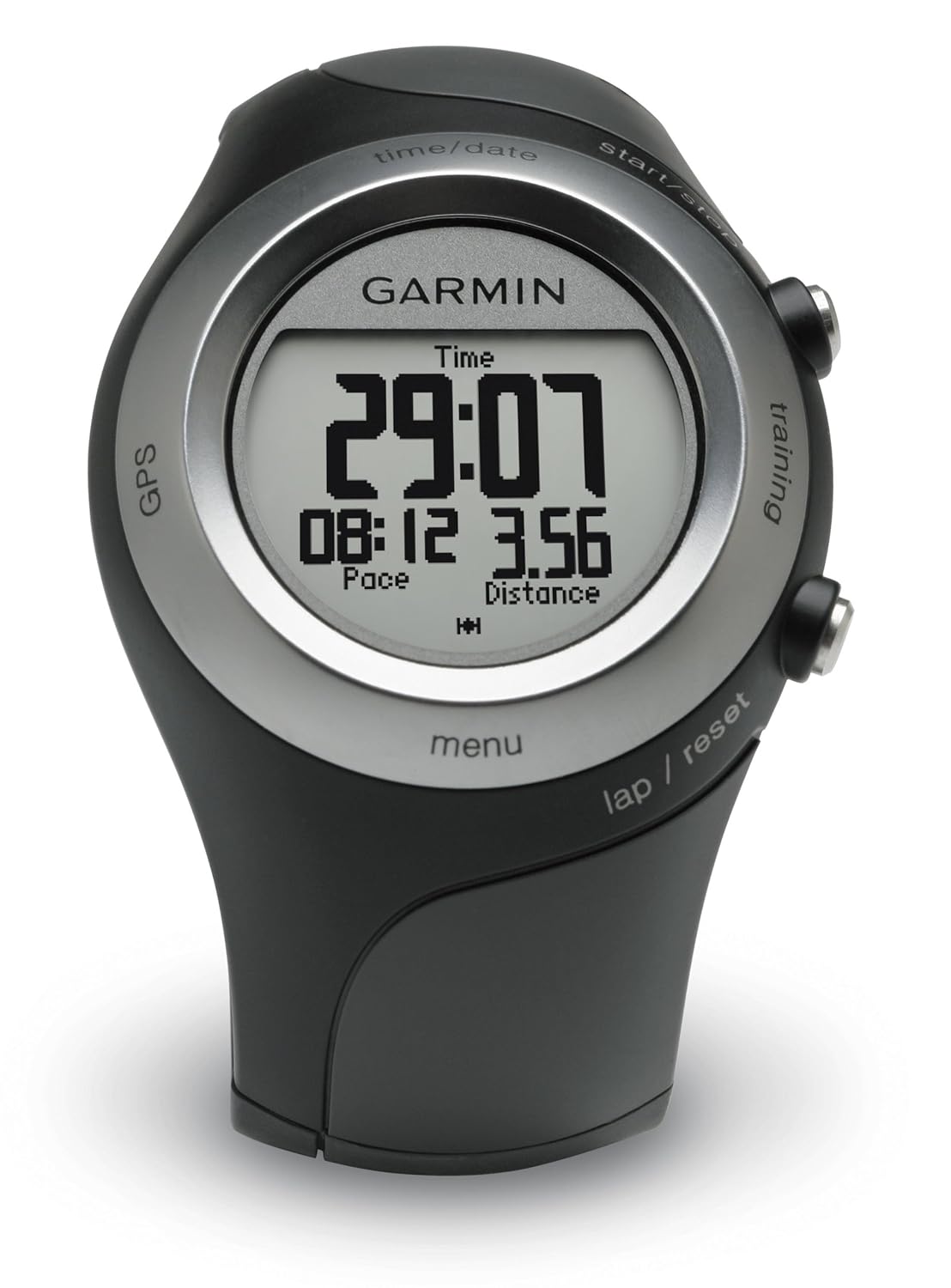
In the category of GPS, I'm a big fan and a stock-owner in Garmin.  I started off with a Garmin 12XL way back in 1998.  When I got bit by the geocaching bug, I upgraded to the Garmin GPSMap 60CSx, which I still love and use a lot.  It was sorta bulky for carrying with me when I went running outdoors, so a few years later my wonderful wife gave me a Garmin Forerunner 405.  There were things I liked and things I didn't like about the Forerunner.

Forerunner Likes
- Compact / Wrist-worn.  As previously mentioned, it was a little awkward running with the bigger handheld GPSMap 60CSx in my hand.
- Automatic Wireless Data Uplink.  I loved that all I had to do was walk into the same room as my computer, and my Forerunner would automatically start wirelessly transmitting the data from my run / hike / kayak / outdoor adventure-du-jour to my computer.  It would upload automatically to the Garmin Connect website where I could see where my outdoor adventure took me on a Google street map or satellite image, along with plots of my altitude, speed, heartrate, and anything else I could want to analyze.

Forerunner Dislikes
 
- Sort of like Gizmo in the movie Gremlins.  DON'T GET IT WET! 

Yes, yes, it's water resistant and wasn't damaged by getting wet.  However, the Forerunner was minimalist on buttons and instead had a touch-sensitive bezel to operate it.  It was pretty cool, but the first time I went running in the rain, oh my!  I discovered it treated every rain drop as a touch and activated all sorts of different sub modes and features.  I think it was telling me how many calories I burned in Swahili, but it wouldn't let my legitimate touches get it back to the display screen that I actually wanted. 

Okay, no problem.  If you push both buttons at the same time, it locks (or unlocks) the bezel.  I would just lock it before going on a hike in the rain or going kayaking where it might get splashed.  I just couldn't change screens or modes while it was wet.

- Battery life was meh.  I could use it one day for a GPS activity outdoors and then would need to recharge it.  If I hadn't recharged it in the previous couple of days, then the battery was likely to die in the middle of my excursion.

Again, no problem.  It was manageable.  I just made a point to put it on the charger the night before any outside activities.

Overall, I liked the Forerunner and used it A LOT.  I've got 153 entries in my Garmin Connect log dating back to October 2008 to prove it, and you can see the Garmin Connect widget on most of my hiking and kayaking blog posts.
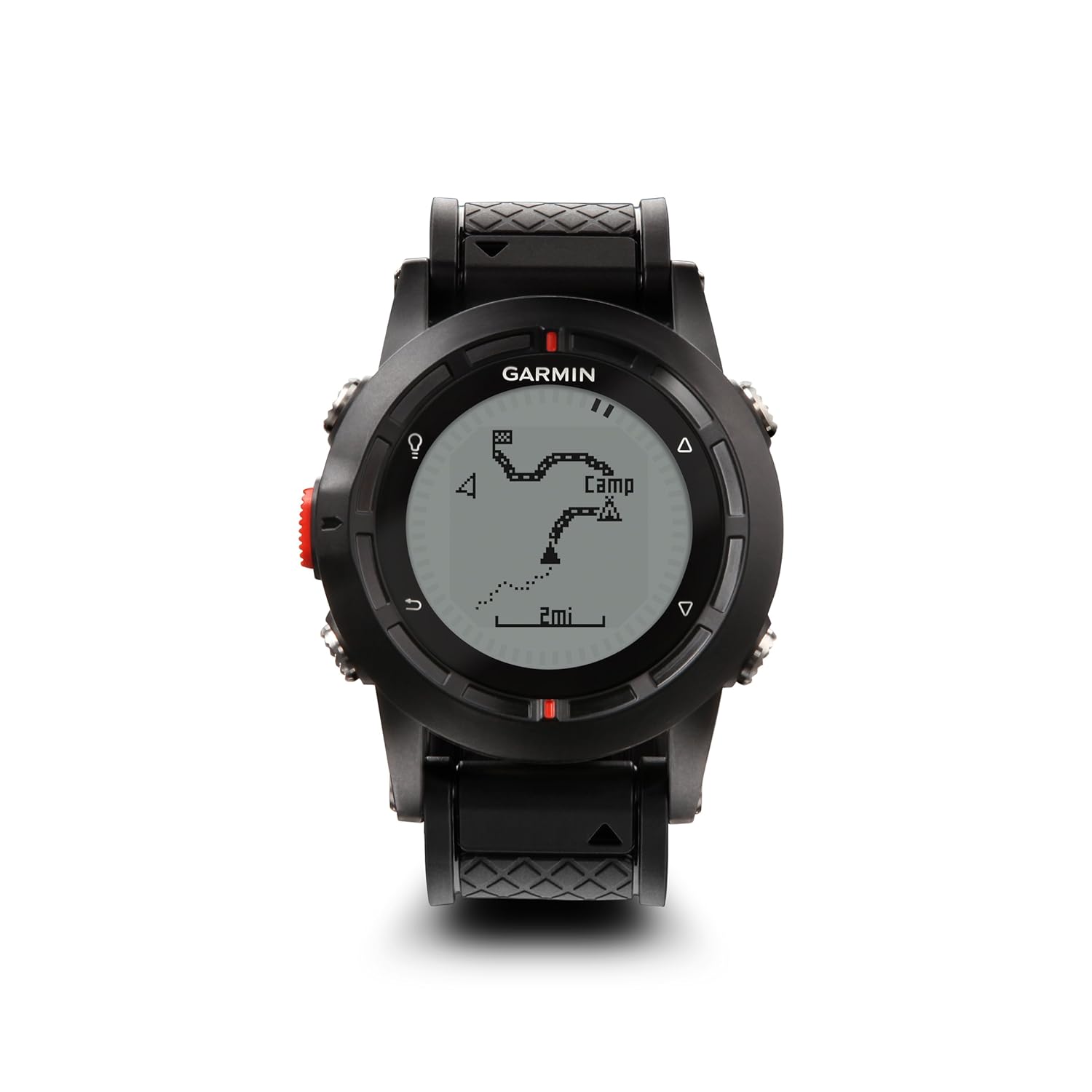


Enter the Fenix.


I was pretty excited when I read about the Fenix on the Garmin website, primarily because it's waterproof and the battery life is much better than the Forerunner.  I got the Fenix in the autumn just before leaving on patrol, so I haven't taken it out on any real outdoor adventures kayaking or hiking yet, but I've been messing around with it on my way to and from work and while at sea.

So far, it's living up to my expectations.

Got wet?  No problem!  It's been pouring rain here and with five buttons on the Fenix, I can do any sort of manipulations I want while it's wet.  No touchscreen to go haywire with rain drops.

The battery has been doing GREAT.  With the old Forerunner, my only battery indication was when the Forerunner DIED (typically in the middle of a run or hike).  The Fenix has a handy indication on the screen to tell you the exact percentage charge status of the battery.  I have been able to use it for weeks at a time just as a watch with the GPS turned off.  I have also used it for several hours at a time standing on the bridge of a submarine with the GPS turned on and had PLENTY of battery capacity left over.

I love that it is very adaptable.  You can have as many or as few screens as you want.  You can customize each screen with different data parameters to display.  You can customize the buttons to do just about anything except order a pizza. 

I like that it monitors temperature and includes that in the plot of speed and other parameters on Garmin Connect.  Now, the temperature reading isn't accurate when it's on my wrist and sensing my body heat, but I've been using it in very cold environments, attached to the outside of my cold weather gear.  I also got one of the remote temperature sensors that I will attach to my backpack when I go hiking in the summertime, and it will wirelessly transmit the temperature to the Fenix at some periodic interval. 

My only complaint about the Fenix is: No automatic uploads.  It doesn't transmit wirelessly like the Forerunner did.  I'm okay with that.  I don't mind plugging in a USB cable.  The frustrating part is when I open Garmin Connect, it "sees" the Fenix is there and plugged in, and I click on "upload activities," and it says there are no activities to upload.  In order to get the data from my Fenix into Garmin Connect, I have to manually open the file and import it into Garmin Connect.  So it's a little labor intensive, but I can live with that.  

Overall, I'm ecstatic with the Fenix, and I'm anxious to go try it out hiking and kayaking now that I'm back in port.

Sunday, October 3, 2010

Bike Log: C&O Canal Tow Path

This post is time-late. I started to write it and had troubles getting Blogger to upload photos, and I didn't get around to finish it until now.

My life has been pretty busy lately and I obviously haven't had much time for blogging. I'm in the midst of going through a series of fairly intense Navy schools. I was fortunate enough to have a week off between schools though, and I put the time to good use getting several errands run and projects done around the house.

On the Thursday of my week off (just after Labor Day), my friend Bob and I went for a 20 mile bike ride on the C&O Canal Tow Path, and it was awesome.

You may recall last year, Bob and I rode our bikes 13 miles from Point of Rocks, MD down to White's Ferry. This time, we started from the same spot under the Rt. 15 bridge at Point of Rocks, but we rode 10 miles upstream toward Harpers Ferry. Then we turned around and came back with a stop in Brunswick, MD for an awesome lunch at El Sloppy Tacos.

Starting off under the Rt. 15 bridge
at Point of Rocks, MD

On the C&O Canal Tow Path

Lock 29 and the Lock House

We passed Locks 28, 29, and 30 along the way. It was interesting to see signs at various places showing how high previous floods had risen. One flood, I think it was in 1996, brought the water level of the Potomac River up to the second floor of that lock house above.

We passed the remnants of the Catoctin Aqueduct.

This beautiful stone arch structure was originally built in 1832-1834 and was one of 11 stone aqueducts along the C&O Canal (such as the very nicely restored Monocacy River Aqueduct).
It collapsed back in 1973, but they salvaged the old stones from the Catoctin Creek and are raising funds to rebuild it to look exactly like it was with the original stones. If you want to sponsor one of the stones, then you can visit their adopt-a-stone website.


Of course, I had to stop and take pictures of flowers here and there. This was my favorite flower photo of the day. I am having trouble identifying the flower in my book though. Anybody able to help name this one? 
Update 10/21/2010: According to the Virginia Tech weed identification guide, this is a Wingstem flower (verbesina alternifolia). 

We turned around when we got 10 miles from Point of Rocks. It just happened to be exactly where the Appalachian Trail joins the C&O Canal Tow Path just shy of Harpers Ferry, WV.

On our way back, we stopped at El Sloppy Taco in Brunswick, MD. On a previous trip through town, my friend Bob had noticed this little hole-in-the-wall Mexican joint and immediately thought of me. Not sure why he would think of me, but... Anyway, it had pretty good reviews on Yelp. Being the Mexican food addict connoisseur that I am, I must say that was a darn good tinga poblano burrito.

A glimpse of the Point of Rocks Bridge over the Potomac River on our way back.

Trip Stats
20.1 miles
Moving Time 2 hrs 35 min
Stopped Time 30 min 52 sec
Moving Average 7.8 mph

I turned off the GPS while we were eating lunch in Brunswick. Unfortunately, that broke my Garmin Connect download into two separate trips. This is my primary gripe against Garmin Connect: It won't let you edit the data to combine two data sets into one trip or to delete data off the end of a trip when I forget to stop and turn off the GPS. Oh well.

So this was the first part going up until lunch...


...and this was the second part from lunch back to Point of Rocks.


Overall, it was another awesome day out riding. As we prepare for the moving truck to come and yet another PCS move takes us away from NoVA, I will miss the awesome hiking, biking, and kayaking we've been able to enjoy here.

Thursday, April 29, 2010

Mark Your Calendars: Bike to Work Day 21 May

Heads-Up:  Friday, 21 May 2010 is the Washington Area Bike to Work Day.
For those of you who live close enough, give it a shot!  It's great for exercise and avoids the traffic. 

For those of you who like to PT in the mornings, like me, beware!  I found out it was Bike to Work Day the hard way last year.  I went out for a run on the Mount Vernon Trail that morning and felt like a salmon struggling against the current to swim upstream.  There were a LOT of bikes on the Mount Vernon Trail that day.  It might be a good day to do your run inside on the treadmill to avoid becoming road-kill.

Saturday, April 17, 2010

Spring Blossoms

I'm still catching up on my photos from spring break.  We drove most of the way back from Orlando on Saturday.  Easter Sunday morning we got up and finished the drive.  We encountered a bit of unexpected traffic and didn't get back into Loudoun County until about noon, so I was disappointed we missed church.

We arrived at home to find a simply stunning array of spring blossoms around our house that weren't there when we left on vacation, so I had to grab my camera.


You can see the trees were damaged by the weight of the snow back in February.


While the beauty of spring inspired me to get my camera, for some odd reason it inspired the boys' entrepreneurial spirit.


The lemonade stand didn't work out so well, and the boys wanted to go for a bike ride.  So we went for a ride around the neighborhood.


First the boys wanted to ride over to the Broadlands Shopping Center to see if the fountain was turned on yet.  (It was.)  They specifically wanted to make a wish and throw a coin in, and they brought their own coins.  They even brought an extra coin for me so I could make a wish, too.

Then we rode over to one of the nearby playgrounds where I got to exercise my arms a bit.

It was a very nice afternoon to unwind and enjoy spring before heading back to work and school the following day.

Saturday, March 20, 2010

Welcome Spring!

What a gorgeous day we had in NoVA today!

Although the trees are still mostly bare, we have signs here and there - a preview of coming attractions:


We got the bicycles down out of the garage ceiling hoists for the first time this year.


This was the first time for 6 year old YB riding on tagalong with me while 8 year old ES rode on his own bike.


We had a great time. After two long laps around our neighborhood, ES was tired and went in the house, but YB wanted to keep going (go figure - he wasn't really pedaling). I captured some AWESOME video of YB singing a joyful song with lyrics something along the lines of:
I'm having fun,
I'm having fun,
This is the best weekend ever,
I'm having fun
Without [ES] disturbing me,
I want to do this again tomorrow,
This is the best weekend ever.
Or something like that. (The video is posted to Facebook for my family and friends' amusement.)

Stupid Kevin Tricks, Vol 37, Ed 5,842

I managed to draw the first blood of the season. I hadn't even gotten on my bike to start our ride. As I was swinging my leg over the bike, my foot got caught in between the seat and the frame, and the momentum of me swinging my leg over caused all of my body weight to go toppling over onto the other side of the bike without being able to put my foot down to stop me (because it was stuck in the bike frame).

Woops.

Smoooooooth. Yep, that was pretty embarrassing. My wonderful wife was standing right there when it happened, and she very kindly stifled her laughter and got the first aid kit.

A tootsie roll pop sure made it feel better though. :-)

Sunday, October 4, 2009

Great Allegheny Trail bike ride

Saturday I went for an awesome bike ride on the Great Allegheny Passage trail. This was with the same friend from church that did the C&O Canal bike ride a few weeks ago. This time though, we had both our families drive us up to Meyersdale, PA. They dropped us off there, did some sightseeing and had lunch, parked one of the cars for us in Cumberland, MD, and headed home in the other car. That left for the two of us bicycle commandos to make the 33 mile trek from Meyersdale down to Cumberland to find the car and drive ourselves home.

Arriving at the Meyersdale train station.

This is another one of those rail-trails - a former railroad that was converted into a bicycle / jogging / walking trail. The old train station in Meyersdale has been very nicely refurbished thanks to generous charitable donations, and they have a pretty decent museum inside considering the size and charitable funding source of the operation.

Getting underway from Meyersdale

The trail is hard-pack dirt and fine gravel, so you don't get any of the Lance Armstrong wanna-be speed-demons like you do on the W&OD Trail through Ashburn.

The first 9 miles was uphill from Meyersdale up to the Eastern Continental Divide. However, thanks to it being an old railroad, it was a gentle slope. I got a good workout from it and was breathing heavy when we got to the top, but it wasn't too tough. According to my GPS, we averaged 8 mph on the uphill leg.

Keystone Viaduct

The highlight of the uphill leg of the trip was seeing the Keystone Viaduct. This magnificent structure was refurbished recently to help complete the Great Allegheny Passage trail from Pittsburg to Cumberland.

Autumn is in full swing up there in Allegheny County, and the trees and windmills just beyond the Keystone Viaduct were gorgeous.

This is the small bridge-tunnel at the Eastern Continental Divide. There are nice murals on both sides of the tunnel.

The view looking back down the way we came.

Statistics at the Eastern Continental Divide.
8.42 miles 0.0 mph current speed
59 min 30 sec moving 8.5 mph moving average
15 min 29 sec stopped 12.3 mph maximum speed
2394 feet altitude at Eastern Continental Divide


Altitude Profile.

We overheard someone on the trail say that for the downhill section through Frostburg to Cumberland, you don't need pedals on your bicycle - just brakes. Whereas our average speed was 8 mph going uphill, we ended up averaging between 13-15 mph going the rest of the way down to Cumberland.

We saw a lot of caterpillars along the way - mostly either black & white ones or black & red ones. Something struck me as odd though. They all seemed to be crawling WITH the flow of traffic on the trail. I would think a caterpillar would want to spend as little time as possible ON the trail and would try to CROSS the trail to get to where the green stuff is that they can EAT. Every single caterpillar we saw was crawling along the trail as if they were going the same place we were (or back the way we came).

Self portrait with orange autumn tree

There were three tunnels along the way. The first and by far the longest was the Big Savage Tunnel.


Big Savage Tunnel

There's a wonderful view just as you come out the other side of the Big Savage Tunnel.

Crossing the Mason-Dixon Line back into Maryland

Shortly after we crossed the Mason-Dixon Line, I decided I needed a drink. I tried flipping the valve on my Camelbak bite valve open to take a drink, and the yellow part of the valve popped out! Doh.

This resulted in the contents of my Camelbak bladder spewing all over the front of my body with nothing to hold the water back. I squeezed hard on the brakes. Note to self: Bicycle no stop quickly on fine gravel. I must've left 15 foot long skidmarks on the trail as I came to a screeching halt. I stuck my finger in the hole where the bite valve used to be and walked back up the trail to retrieve the missing piece. Luckily it popped right back into place and I didn't have any further troubles with it.

Borden Tunnel

A Frostburg church steeple peeking out above the trees

Our plan had been to stop and eat lunch in Frostburg, MD. Unfortunately, we did not realize that the path does not run through Frostburg. It actually runs BY Frostburg, but at the bottom of the hill from the town. If we wanted to go into town for something to eat, it would have been a steep half mile climb up into the town.

Frostburg Rest Area

There was a nice rest area alongside the trail there in Frostburg though, so we just ate the snacks we brought in our backpacks and kept going down the trail.

Brush Tunnel

After leaving Frostburg, the trail runs right alongside the railroad tracks for the Western Maryland Scenic Railroad. From this point on, we noticed a higher number of bicyclists on the trail. It turns out, you can ride the railroad from Cumberland up to Frostburg, then ride your bike back down the hill again. That sounded like a pretty cool idea to me - I may try that someday with my family.


Near the Brush Tunnel, we stopped to find a geocache, only there was a snake guarding the geocache. He looked peaceful enough at first...

...then I poked him with a stick. I expected him to scurry away. Nope. He didn't like me one bit. He hissed and inflated himself to twice the diameter he was before, then adopted this coiled S-shaped spring posture and tried snapping at me. I've been trying to identify him. I think he's either a garter snake or a ribbon snake.

The trail is well-marked with mile-markers along the way. The numbers tell you miles from Cumberland, so I took this photo to show we were in the home stretch.

We saw lots of the same flowers alongside the trail - very small white flowers and purple flowers mostly.

Toward the end of the trip though, I spotted only a couple of these, and I thought they were the nicest flower we saw on our trip.

Then in the last mile before Cumberland, we spotted these purple flowers with Monarch butterflies all over them.

The Allegheny Trail ends in Cumberland right where the C&O Canal Towpath begins.

Western Maryland Scenic Railroad Station

Beginning of the C&O Canal Towpath

Turning Basin at the end of the C&O Canal

Overall Trip Statistics
33.1 miles 0.0 mph current speed
3 hours 26 min moving 9.6 mph moving average*
1 hour 32 min stopped 20.3 mph maximum speed
632 feet altitude in Cumberland

* This average speed includes the uphill segment. We actually did between 13-15 mph most of the downhill portion of the ride.

We stopped and had an excellent dinner at a place called the Crabby Pig right next to the end of the C&O Canal, then we piled in the car and headed back home again. Overall, it was a great trip and I hope to do it again someday, especially the downhill section with my family.

Statistics for today:
1,790 feet elevation drop from Eastern Continental Divide to Cumberland (approximate)
1,320 caterpillars spotted on the trail (give or take)
165 pictures taken
33 miles ridden on our bikes
3 railroad tunnels we rode through
3 hours driving to Meyersdale / hours driving home from Cumberland
1 bug in the mouth (I spit it out)
1 bug in the eyeball because I didn't put my sunglasses back on when we came out of the Big Savage Tunnel