Showing posts with label GPS. Show all posts

Saturday, April 27, 2013

Forerunner versus Fenix


You don't have to read my blog for long to know that I'm a gadget freak.  I love electronic gadgets.  When I go hiking or kayaking, I need a nerdy vest with half a dozen pockets to hold the GPS, the phone, the camera, etc.

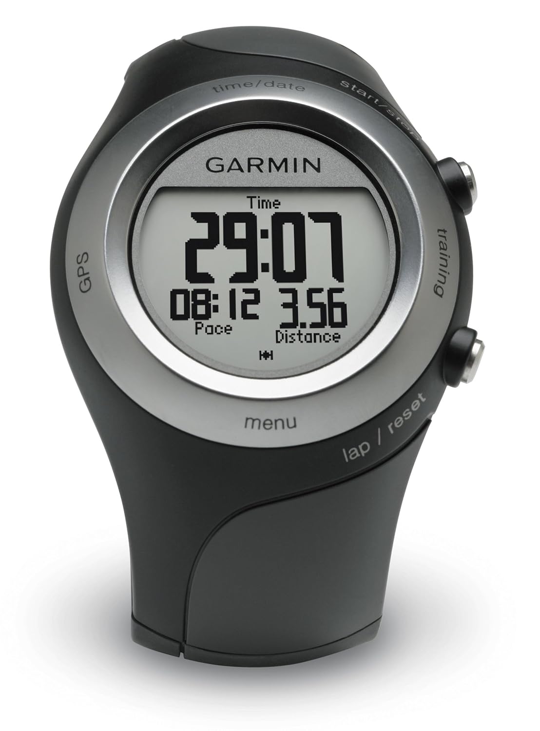
In the category of GPS, I'm a big fan and a stock-owner in Garmin.  I started off with a Garmin 12XL way back in 1998.  When I got bit by the geocaching bug, I upgraded to the Garmin GPSMap 60CSx, which I still love and use a lot.  It was sorta bulky for carrying with me when I went running outdoors, so a few years later my wonderful wife gave me a Garmin Forerunner 405.  There were things I liked and things I didn't like about the Forerunner.
Forerunner Likes
- Compact / Wrist-worn.  As previously mentioned, it was a little awkward running with the bigger handheld GPSMap 60CSx in my hand.
- Automatic Wireless Data Uplink.  I loved that all I had to do was walk into the same room as my computer, and my Forerunner would automatically start wirelessly transmitting the data from my run / hike / kayak / outdoor adventure-du-jour to my computer.  It would upload automatically to the Garmin Connect website where I could see where my outdoor adventure took me on a Google street map or satellite image, along with plots of my altitude, speed, heartrate, and anything else I could want to analyze.

Forerunner Dislikes
 
- Sort of like Gizmo in the movie Gremlins.  DON'T GET IT WET! 

Yes, yes, it's water resistant and wasn't damaged by getting wet.  However, the Forerunner was minimalist on buttons and instead had a touch-sensitive bezel to operate it.  It was pretty cool, but the first time I went running in the rain, oh my!  I discovered it treated every rain drop as a touch and activated all sorts of different sub modes and features.  I think it was telling me how many calories I burned in Swahili, but it wouldn't let my legitimate touches get it back to the display screen that I actually wanted. 

Okay, no problem.  If you push both buttons at the same time, it locks (or unlocks) the bezel.  I would just lock it before going on a hike in the rain or going kayaking where it might get splashed.  I just couldn't change screens or modes while it was wet.

- Battery life was meh.  I could use it one day for a GPS activity outdoors and then would need to recharge it.  If I hadn't recharged it in the previous couple of days, then the battery was likely to die in the middle of my excursion.

Again, no problem.  It was manageable.  I just made a point to put it on the charger the night before any outside activities.

Overall, I liked the Forerunner and used it A LOT.  I've got 153 entries in my Garmin Connect log dating back to October 2008 to prove it, and you can see the Garmin Connect widget on most of my hiking and kayaking blog posts.


Enter the Fenix.


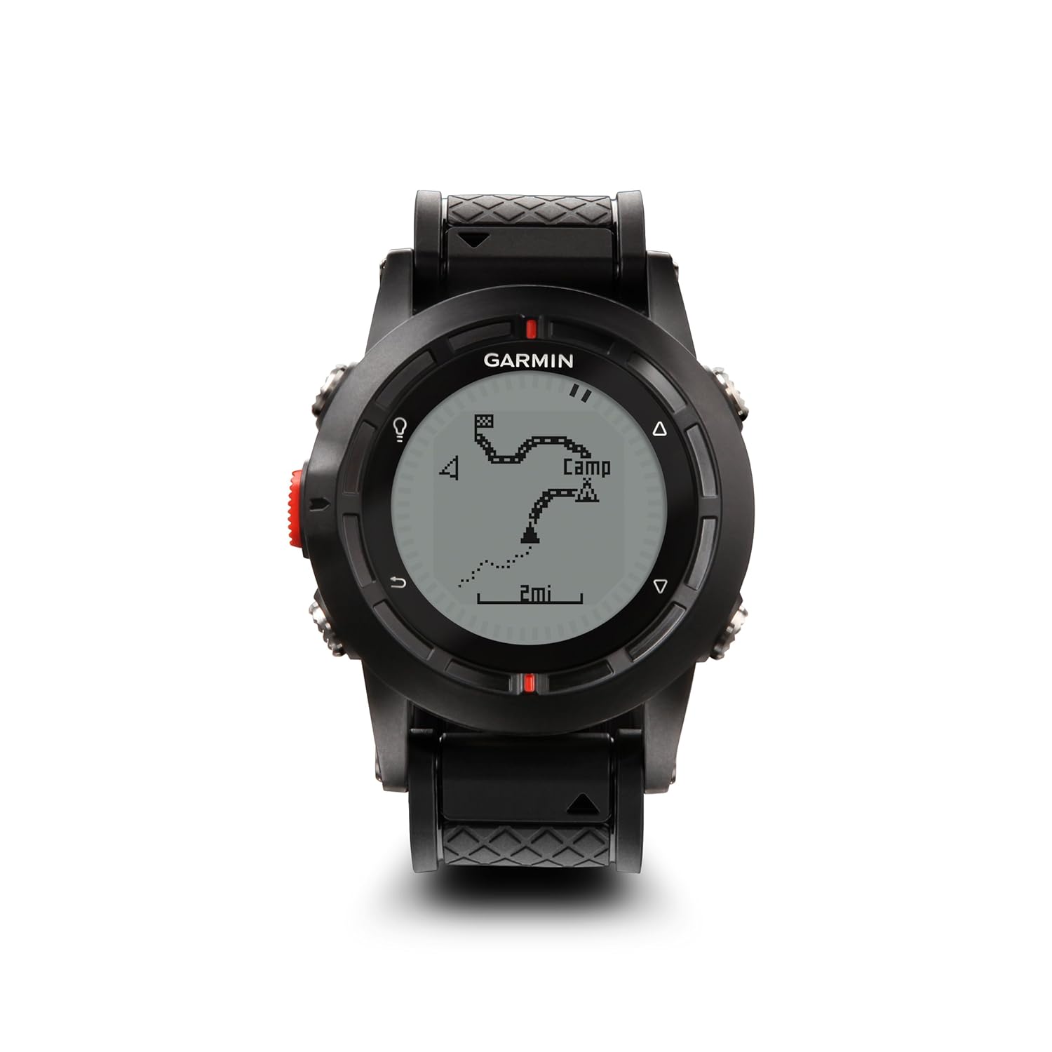
I was pretty excited when I read about the Fenix on the Garmin website, primarily because it's waterproof and the battery life is much better than the Forerunner.  I got the Fenix in the autumn just before leaving on patrol, so I haven't taken it out on any real outdoor adventures kayaking or hiking yet, but I've been messing around with it on my way to and from work and while at sea.

So far, it's living up to my expectations.

Got wet?  No problem!  It's been pouring rain here and with five buttons on the Fenix, I can do any sort of manipulations I want while it's wet.  No touchscreen to go haywire with rain drops.

The battery has been doing GREAT.  With the old Forerunner, my only battery indication was when the Forerunner DIED (typically in the middle of a run or hike).  The Fenix has a handy indication on the screen to tell you the exact percentage charge status of the battery.  I have been able to use it for weeks at a time just as a watch with the GPS turned off.  I have also used it for several hours at a time standing on the bridge of a submarine with the GPS turned on and had PLENTY of battery capacity left over.

I love that it is very adaptable.  You can have as many or as few screens as you want.  You can customize each screen with different data parameters to display.  You can customize the buttons to do just about anything except order a pizza. 

I like that it monitors temperature and includes that in the plot of speed and other parameters on Garmin Connect.  Now, the temperature reading isn't accurate when it's on my wrist and sensing my body heat, but I've been using it in very cold environments, attached to the outside of my cold weather gear.  I also got one of the remote temperature sensors that I will attach to my backpack when I go hiking in the summertime, and it will wirelessly transmit the temperature to the Fenix at some periodic interval. 

My only complaint about the Fenix is: No automatic uploads.  It doesn't transmit wirelessly like the Forerunner did.  I'm okay with that.  I don't mind plugging in a USB cable.  The frustrating part is when I open Garmin Connect, it "sees" the Fenix is there and plugged in, and I click on "upload activities," and it says there are no activities to upload.  In order to get the data from my Fenix into Garmin Connect, I have to manually open the file and import it into Garmin Connect.  So it's a little labor intensive, but I can live with that.  

Overall, I'm ecstatic with the Fenix, and I'm anxious to go try it out hiking and kayaking now that I'm back in port.

Wednesday, March 31, 2010

Spring Break - Family Vacation Part 1

Friday afternoon, my wonderful wife picked up the boys from school, picked me up from work, and we headed south to spend Spring Break in Orlando.

Having four of us in the car, the HOV-3 lanes on I-395 were nice while they lasted, but we got stuck in some pretty gnarly traffic once the HOV lanes ended. We stopped in Lumberton, NC for the night and then finished the drive to Orlando on Saturday.

On our way, we stopped to visit the Tuskegee Airmen Memorial in South Carolina. Yes, yes, there was a geocache there. This was my first geocache in South Carolina and my 500th geocache find overall.

Self portrait in front of the Tuskegee Airmen Memorial

The boys helped me find the geocache by figuring out the answer to the question on the old Army Air Corps beacon.

I'm always looking for unique local places to eat instead of national chain restaurants. Thanks to Yelp, we found Ronnie's in Savannah, Georgia. It's a small burger, fries, onion rings, and milk shakes kind of place. The lady at the counter asked in a slow Southern drawl if we wanted our burgers "all the way." We said we didn't know what that meant. She said, "Y'all aren't from the south are ya? Are y'all headin' to Disney World?" Wow... how'd you guess?


HUMONGO Onion Rings
(Aside: Why does he have a cow when there are diced onions in any other item of food placed in front of him, but he'll gobble up onion rings like there's no tomorrow???)

My wife said, "this was better than that place you dragged us to in Kansas." I can't say that I agree with that. The food was probably of the same taste and quality, but I think the ambiance was a little more unique at the Crazy R in Kansas, and the menu at the Crazy R certainly had more of a local flavor to it. :-)

Each time we have come here in the past, we have spent most of the week just enjoying the pool at the Marriott Harbour Lake resort, and we devote one day to making our token visit to Disney. We figure as the boys get older, we will eventually branch out and hit other spots like Universal Studios.

Sunday and Monday we spent here at the resort hanging out by the pool.

The pirate ship in the pool.

A fleeting glimpse of YB as he races off to
man the water cannons on the pirate ship.

A sighting of the elusive YB-fish.

Come a little bit closer Daddy.

Cue Admiral Akbar sound bite: IT'S A TRAP!

Tuesday we made our pilgrimage to Disney World.

This is the first time we've attempted
to go during Spring Break. :-$

The monorail was shut-down, so everyone
had to wait in long lines and take the ferry
across the lake to the Magic Kingdom.

Thanks to the wonders of digital photography, I find taking a quick snapshot of my watch with something in the background is a helpful log of our activities for the day. This photo is at the front entrance to the Magic Kingdom. Yeah, we left the resort about 9:15. It only took us about 10 minutes to drive to Disney. The other 80 minutes were spent riding the tram in from where we parked and then waiting for the ferry to cross the lake.

Here's a recap of our day's visit to the Magic Kingdom:

- 10:46 a.m. walked in the Main Entrance

Have fun stormin' the castle!
(This was our first sighting of the castle after entering the park.)

- Walked over to Tomorrow Land

- Picked up fast passes for 3:55 p.m. at Space Mountain

- Rode the Buzz Lightyear ride (40 minute wait)

On the Buzz Lightyear ride you actually get to control
your turret - spinning left or right, and you each get
a laser blaster to shoot at all the things marked with
Z (for Zurg) and rack up a score for everything you hit.

Self portrait with ES in the Buzz Lightyear ride

- Walked over to Fantasy Land

- Scoffed at the 120 minute wait for the Dumbo ride (YB's favorite from our last visit)

- Bought some hot dogs for lunch

- Couldn't find any place to sit down, so we ate our lunches standing by the Dumbo ride

- Walked to Frontier Land

- Time Stamp: 12:26 p.m. getting in line for Haunted Mansion

YB watches the paddle-wheel boat while
waiting in line at the Haunted Mansion.

- Rode the Haunted Mansion ride (35 minute wait). ES wanted to go again, YB was a little creeped out by it, but he later said he wanted to do it again.

- Picked up fast passes for 4:30 p.m. at Thunder Mountain

- Rode the Pirates of the Caribbean ride (45 minute wait). Boys said it was "boring."

- Walk through the Swiss Family Robinson tree house. This was cool for us since we just recently watched the movie for family movie night, but it's probably pretty boring if you aren't familiar with the book or the movie.

- Ate some Dole Pineapple Whip! This was the first time we've had Dole Pineapple Whip since we left Hawaii.

- Walked back over to Tomorrow Land - observed Main Street Parade with Mickey & Minnie Mouse dancing on a float on the way.

- My nephews insisted Space Mountain is the best ride EVER, so I went with them on Space Mountain with them while everyone else went on the People Mover.

- I got off Space Mountain feeling like someone had just pulled me out of the clothes dryer - spinning lights, spinning stomach, happy nephews.

- Walked back over to Frontier Land to ride Thunder Mountain. This was the first time for both of my boys on an honest-to-goodness roller coaster, and I was a little worried they would wig out. I was pleasantly surprised. We came off the ride with YB saying, "AGAIN! AGAIN!" and ES saying, "The only way to survive was by screaming!" Actually, both boys wanted to go again, but there was a 60 minute wait and we said no way.

- About this time, my wife and I were exhausted and the boys were clearly "done", so we agreed it was time to head back.

We got on the train to go back to the main entrance at 5:40 p.m.

We stopped for a Blunoz Family self portrait at the main entrance.

Then we crammed into the monorail like it was
the rush hour on the Metro in DC.

Unfortunately, my Garmin battery
didn't last the entire day in Disney.

Using the Buckeye Outdoors website's route planning feature, I estimate we walked about 3.4 miles. When I got back and recharged the Garmin, I was able to see that we covered 11.85 miles in 7 hours before the battery died. However, I didn't turn it off while we were on the rides, so that wasn't 11.85 miles of walking. As I analyze the data, I expect to see some 2-3 minute spikes in velocity (pace) when we were on Space Mountain and Thunder Mountain.

Using the Garmin Connect website, I found I can share this map of where we went. Yes, yes, I am a nerd / geek / dork / all of the above for sharing this with you, but isn't it COOL???


If you click on "satellite" it will show the track overlaid on top of the overhead imagery of the park. The green bubble with the play symbol at the bottom shows where I started the GPS at the main entrance. There's one odd outlyer of a data point in the lower right when we were on the Buzz Lightyear ride. You can also see two spurious bad data points when we rode Space Mountain. Other than that, it looks like a pretty accurate recording of our visit. At the red bubble with the stop symbol, you can see how the battery died in my watch as we were on the train riding around the perimeter of the park on our way back to the main entrance.

At 6:23 p.m., we were back in our car and headed for dinner.

YB was rather insistent.

Wednesday, September 9, 2009

Ode to my GPS Receiver

If you've been reading my blog for any period of time, then you already know this. Before we even start, for the benefit of any new readers, let me just state this right up front:

I am an electronic gadget nerd.

In response to a recent post of mine, David from Pearl Harbor asked how I like my GPS receiver. Short answer:

I LOVE MY GARMIN GPSMAP 60CSx!

I use it almost anytime I leave the house for any activity.

Driving Across Arizona

- In the car, I use it for car navigation. I bought the Garmin North America database. It does route calculations and guides you to your destination. It doesn't talk like a lot of other fancy GPS receivers do that are specifically designed for car navigation, but that's okay. It gives me a warning beep when I'm coming up on a turn, and it gives me a "turn now" beep when I am at the turn. The North America database comes with business listings, so I can search for nearby restaurants or gas stations or whatever else, and then have the GPS guide me there.

Hiking Diamond Head

- On the trail, I use it to keep track of the mileage and altitude profile of our hike, and sometimes to help me find my way back to the car. Note the "S" in 60CSx means that it has a built in barometric altimeter and magnetic compass. The altimeter gives me nice altitude profiles of our hikes like this one:


Geocaching around Beaver Creek Dam Reservoir

- Geocaching, the compass helps guide us to geocaches when we're close to the hiding spot. Without that "S" in the model number, the GPS would just tell you bearing and range to the geocache, and you would need a separate compass to figure out which way to the geocache.


Plus, this GPS receiver was built with geocaching in mind. If you download all the geocaches within a certain radius of your home or along a route you plan to drive, they will show up as little treasure chest icons on the geographic display. After you have found the geocache, you click "FOUND" and it changes the symbol from a closed treasure chest to an open treasure chest. Looking at my GPS map, I can easily tell which geocaches I have found and which I have not. Alternatively, I can delete waypoints of a certain type. So if I don't care about the geocaches I've already found and want to clean up the screen, I can delete all found geocaches and all the open treasure chest symbols will go away.


- On my bike, it easily clicks into place on my handle-bar mount. It helps me keep track of where I am, how far I've gone, and what my average and max speeds were.


- On the water, I use it both out boating and kayaking for navigation, keeping track of where I am, where I've been, and statistics like mileage, elapsed time, and average speed. When we take the boat out to our favorite cove on Lake Winnipesaukee to go swimming, there is an unmarked rock in the middle of the cove. I swam over to it with my GPS and marked it as a waypoint with a stay-clear warning radius around it, so it will beep at me if we get too close to it. Likewise, after we set the anchor, I set another radius circle warning to tell us if we're dragging the anchor.
The 60CSx is waterproof and has gaskets around the battery compartment and external cable connections. I don't think I would ever intentionally submerge it, but I have had it out in some pretty torrential downpours hiking in Hawaii, and it's gotten plenty wet out kayaking lately with no problems.

Other features: This is the Xtreme version that came out in January 2006. When they added that little "x" to the model number, they added a couple of very important features: the SiRF III chip and expandable memory.

SiRF III: The SiRF III chip is a super-sensitive receiver that enables the 60CSx to pick up very weak GPS signals bouncing off of tall city buildings or trees. The result is that I can sit here inside my house in my comfy family room chair and get a GPS fix. Or, I can get a fix under a heavy tree canopy in the summertime. Or, I can get a fix in a busy downtown city environment surrounded by tall buildings.

Expandable Memory: The x version of the 60CSx also has a microSD card slot. I put a 2GB microSD card in there, and I was able to load ALL the road maps for everything from Norfolk, VA up to Lake Winnipesaukee, NH (along with the accompanying business database for restaurants, gas stations, etc). During our drive across country last summer, I loaded it with all the maps for the west coast from Oregon down to San Diego, then most of the maps for the drive across country. (I think the microSD card was full at about Ohio or so, and I had to empty the maps and reload it with the maps for the rest of the trip.)

In summary, the Garmin 60CSx is a rugged and reliable workhorse of a GPS receiver, and I use it for just about everything I do outside the house. I would highly recommend it for anyone who likes doing outdoor activities - whether it's running, hiking, biking, geocaching, kayaking, boating, or driving your car around town.

Aside about running: I did, in fact, use this GPS for running, too. It's a little bulky and I carried it in my hand as I ran. I mainly used it for running unknown paths like the first time I ran the trails in Eleanor Lawrence Park over in Chantilly, VA. Once I was familiar with the route and the mileage, then I wouldn't continue carrying it around with me.

Click here to visit the Garmin web page for the 60 CSx specifications.

Note: Garmin didn't pay me a dime to write this blog post. These are all my own opinions from owning and using my Garmin 60CSx.