Friday, October 22, 2010

Pentagon Gouge: Navy Working Uniform (NWU)

Like me, some of you have been in the National Capitol Region (NCR) for a while and not allowed to wear the new Navy Working Uniform (NWU).  As I prepare to execute my next set of PCS orders, I have found it necessary to embark on the quest for my own set of NWUs.

It has NOT been a smooth or easy process.

In the interest of helping you, my shipmates out, please allow me to offer the following recommendations for making your NWU purchase easier than mine.

Step 1)  Realize that the NWUs come in a completely new and different sizing system.
    Since the Navy uniform shop is INconveniently located in the bowels of the Navy Annex, I really didn't want to go out of my way to make the pilgrimage to the uniform shop only to find they didn't have what I needed.  So I had this bright idea to order my NWUs online.  The Navy Uniform website is actually a pretty good site.
    Unfortunately, I got to the website and discovered that you can't just order a size large blouse or type in the waist-size and inseam for my trousers.  Each have TWO sizes on their label, like "L/R," "M/L," or "L/L."  Huh?
    Okay, note to self:  For the initial purchase of my NWUs, I should probably actually GO to the uniform shop and try them on.
    But wait!  Don't leave the website yet!

Step 2)  Go ahead and order the name strips, rank insignia, warfare pin, and U.S. Navy strip from the website.
    They get it done pretty quick and ship it to your home.  The name strips take a few days to do, but it'll help make things go smoother when you already have them in hand.  The other stuff could wait, but you never know if they'll be out of your particular rank or warfare pin when you arrive at the uniform shop.

Step 3)  Look up the business hours of the uniform shop before you make the pilgrimage to the uniform shop.
    Did I mention how inconveniently located the uniform shop is in the basement of the Navy Annex?
    Here's what you DON'T want to happen.  You DON'T want to leave work "early" at 1600 in order to make a run to the uniform shop "on the way" home, battle for parking near the Navy Annex, hike to up the hill to the security entrance, and descend to the depths of the building... down the stairs... past the NFCU...  past the mini mart... around the corner... past the gym... alllllll they way down the hallway... and there it is.

The CLOSED sign.

    Yyyyyyyyeah, they closed at 1600.

    I imagine my face was probably red and smoke billowed from my ears (flashback to those jalepeno chips at the NEX in Pearl Harbor) as I walked all the way back up the hallway... past the gym... around the corner... past the mini mart... past the NFCU... up the stairs...  back through security... and back down the hill to where I parked my car again.

Step 4) Okay, wait, rewind.  Backup to Step 2 above.  
    Note to self:  The NWU requires TWO name-tapes per uniform.  One goes on the blouse.  One goes on the back of the trousers.  On your second trip to the uniform shop (because they were closed the first time you tried), if you go with just two name-tapes in-hand hoping to outfit yourself with two sets of NWUs, then you'll be disappointed. 
    Oops.
    So much for saving yourself some effort by ordering them online before going to the uniform shop.


Step 5) Get all this done so that your new NWUs are ready for pickup BEFORE you detach from your current duty station and turn in your Pentagon badge.  It just makes it easier for getting into the Navy Annex to go back to the uniform shop.  That being said, I'm happy to report that it was not difficult to get a visitor badge at the security shack.  It just would have been quicker and easier if I had done it before turning in my Pentagon badge.

Disclaimer:  Please don't take my gripes about the location of the Navy Annex uniform shop the wrong way.  I do not mean any of this to reflect negatively upon the uniform shop or staff.  It's an excellent, well-stocked uniform shop, and the staff there are extraordinarily helpful.

I just wish the location of the uniform shop was a little more convenient for quicker access.

Sunday, October 3, 2010

Bike Log: C&O Canal Tow Path

This post is time-late. I started to write it and had troubles getting Blogger to upload photos, and I didn't get around to finish it until now.

My life has been pretty busy lately and I obviously haven't had much time for blogging. I'm in the midst of going through a series of fairly intense Navy schools. I was fortunate enough to have a week off between schools though, and I put the time to good use getting several errands run and projects done around the house.

On the Thursday of my week off (just after Labor Day), my friend Bob and I went for a 20 mile bike ride on the C&O Canal Tow Path, and it was awesome.

You may recall last year, Bob and I rode our bikes 13 miles from Point of Rocks, MD down to White's Ferry. This time, we started from the same spot under the Rt. 15 bridge at Point of Rocks, but we rode 10 miles upstream toward Harpers Ferry. Then we turned around and came back with a stop in Brunswick, MD for an awesome lunch at El Sloppy Tacos.

Starting off under the Rt. 15 bridge
at Point of Rocks, MD

On the C&O Canal Tow Path

Lock 29 and the Lock House

We passed Locks 28, 29, and 30 along the way. It was interesting to see signs at various places showing how high previous floods had risen. One flood, I think it was in 1996, brought the water level of the Potomac River up to the second floor of that lock house above.

We passed the remnants of the Catoctin Aqueduct.

This beautiful stone arch structure was originally built in 1832-1834 and was one of 11 stone aqueducts along the C&O Canal (such as the very nicely restored Monocacy River Aqueduct).
It collapsed back in 1973, but they salvaged the old stones from the Catoctin Creek and are raising funds to rebuild it to look exactly like it was with the original stones. If you want to sponsor one of the stones, then you can visit their adopt-a-stone website.


Of course, I had to stop and take pictures of flowers here and there. This was my favorite flower photo of the day. I am having trouble identifying the flower in my book though. Anybody able to help name this one? 
Update 10/21/2010: According to the Virginia Tech weed identification guide, this is a Wingstem flower (verbesina alternifolia). 

We turned around when we got 10 miles from Point of Rocks. It just happened to be exactly where the Appalachian Trail joins the C&O Canal Tow Path just shy of Harpers Ferry, WV.

On our way back, we stopped at El Sloppy Taco in Brunswick, MD. On a previous trip through town, my friend Bob had noticed this little hole-in-the-wall Mexican joint and immediately thought of me. Not sure why he would think of me, but... Anyway, it had pretty good reviews on Yelp. Being the Mexican food addict connoisseur that I am, I must say that was a darn good tinga poblano burrito.

A glimpse of the Point of Rocks Bridge over the Potomac River on our way back.

Trip Stats
20.1 miles
Moving Time 2 hrs 35 min
Stopped Time 30 min 52 sec
Moving Average 7.8 mph

I turned off the GPS while we were eating lunch in Brunswick. Unfortunately, that broke my Garmin Connect download into two separate trips. This is my primary gripe against Garmin Connect: It won't let you edit the data to combine two data sets into one trip or to delete data off the end of a trip when I forget to stop and turn off the GPS. Oh well.

So this was the first part going up until lunch...


...and this was the second part from lunch back to Point of Rocks.


Overall, it was another awesome day out riding. As we prepare for the moving truck to come and yet another PCS move takes us away from NoVA, I will miss the awesome hiking, biking, and kayaking we've been able to enjoy here.

Friday, September 10, 2010

Advice to Junior Officers: Social Media

Back when I was an Ensign (peanut gallery says, "Ooooooh, boy, here he goes..."), I had some great officers and chiefs teach me a lot about life in the Navy.

One nugget I remember was the warning about fraternization.  Now, I'm not talking about male-female fraternization since women aren't yet serving on submarines.  I'm talking about unduly familiar relationships between officers and enlisted Sailors.

It can be tempting as a 23 year old Ensign to become friends with the 23 year old E-4s because you're part of the same generation.  You grew up listening to the same music.  You watched the same movies.  You played the same video games.  You had the same posters on your bedroom walls in high school, worshiping the same teen idols - be it rock stars or sports stars or super models.  You remember the same critical events in history (like where you were on 9-11 or when the Space Shuttle Challenger exploded and how it affected you).  You may be fans of the same sports teams and watched the same World Series or Super Bowl or NBA finals.  You probably have a lot in common except for the fact that one decided to go to college and one decided to enlist in the Navy (which are BOTH honorable choices).  Even so, you can't be friends.  That would be "prejudicial to the good order and discipline" of the command.

Fast forward umpteen years later and enter the world of social media. 

During my tour as XO on the Mighty MSP, social media was still pretty new.  The Navy had not yet embraced social media as the important communication tool that it is, and there were no rules or guidance on whether it was okay or forbidden.  It was just sort of out there.  Sailors were using it.  Most of my wardroom (including me) and our wives got assimilated by the Borg sucked into Facebook.

But nobody ever sat me down and said, "Shipmate, if you're going to be active on social media sites like Facebook, then here are some guidelines and things to consider..."

This ALNAV message (ALNAV 057-10) provides a very broad-brush-stroke, overarching guidance for the use of the social media by Navy personnel, but it is more concerned with not speaking on behalf of the Navy, not violating operational security and/or giving out classified information.   

Aside:  In the process of searching for information on this topic, I discovered that CHINFO has a very useful web page of social media references

This topic of discussion came up during at a leadership school I attended last week.  We asked a lot of questions like:  As an officer in the Navy, is it okay to use Facebook?  Is it okay to "friend" one of your Sailors?  Those are tough questions with no clear right or wrong answer.

Some people will NOT use Facebook (or any other social media site) AT ALL to simply eliminate any risk to their privacy or security or implication of impropriety, and that's okay.  In my case, I find Facebook is a very useful tool for staying in touch with family and friends scattered across the globe.  Plus, as a leader, social media can provide some awareness into what's on your Sailors' minds.  In several instances, it has brought to my attention when a friend or shipmate has been in need of advice or assistance.

While it is a useful tool, it should go without saying that you need to be cautious about how you use social media sites like Facebook.  Keep the privacy settings on lock-down, and follow the good advice in the ALNAV message to minimize the risks of computer security and operational security.  However, I think that's all "Social Media and Internet Safety 101" and doesn't address the questions I mentioned above.  Is it okay for an officer to use social media and not jeopardize the good order and discipline of the command through fraternization or unduly familiar relationships?


For what it's worth, here's my unsolicited advice of the day.

Blunoz's Ground Rules as an O-Ganger on Facebook

Rule #1:  I don't send friend requests to my subordinates.  Consider it respecting their privacy.  If they don't want me seeing into their personal lives and communications with their friends, then that's fine by me (even if it's because they're complaining about that a-hole XO they work for).  If I did send them a friend request, then they might feel pressured or obligated to accept because of my position of seniority / authority in their chain of command.   

Rule #2:  I accept ALL friend requests from my subordinates.  If you accept one, then you have to accept them all.  To accept some and not others would give appearances of favoritism.

If one was concerned about fraternization through Facebook, I suppose one could impose a criteria such as, "I will not accept friend requests from enlisted Sailors."  In my personal experience, I am Facebook friends with many of my enlisted shipmates, and I haven't had any problems with it.  I generally don't post many comments on their pages except to say congratulations for promotions, weddings, births, etc.

Regardless of your personal preference or social media philosophy, it goes without saying that you have to be careful about what you post.  Anything you write on any blog or Facebook post can go viral and end up on the front of the Navy Times.  If you're hanging out at the same places the enlisted crew hangs out, and pictures get posted to Facebook showing you there with them, then it could create the perception of an unduly familiar relationship and/or favoritism with one or more of your crewmembers.  I'm not saying don't go out on the town for fear of running into crewmembers.  I'm also not saying don't take pictures with your shipmates.  I'm just advising you to be aware of the possible perception and be cautious.

What do you think?  

I don't claim to be an expert on this topic.  I'm just sharing my personal philosophy about it.  Do my ground rules make sense, or am I overlooking some other potential pitfall?  Do you have other rules or guidelines for using social media?  I appreciate any feedback you have to offer on this topic in general or on my ground rules above.

Update 10/29/2010: I found an excellent blog post on the topic of Navy leadership and the use of Facebook here: http://seanheritage.blogspot.com/2010/02/wasting-time-for-good-of-team.html.

Monday, August 30, 2010

DC Car Free Day


Heads-up!  DC Car Free Day is Wednesday, 22 September 2010

Like last year, if you pledge on the website that you will not use your car that day, then you will be entered for some free prizes.  I won a $10 gift card to our local bike store last year. 

It's okay if you already use public transit or bicycle to ride to work.  You can still pledge that you won't use your car that day and enter to win the free stuff.

If you check out the DC Car Free Day Facebook Page, you can find other useful information.  For instance, Bike and Roll is offering FREE BIKE RENTALS that day.  Check it out!

Sunday, August 29, 2010

Ragged Island Hike

The boys and I took the boat over to Ragged Island on Lake Winnipesaukee to search for a geocache there.  We were really glad we went for two reasons.

First, we arrived there and found out it is one of the properties owned and managed by the Lakes Region Conservation Trust (LRCT).  There are very nice, well-maintained boat docks at the south end of the island.  There's a welcome kiosk with information about the history of the island.  The best part though was the laminated nature guide you could borrow from the kiosk as you walked the island.  There is a half-mile loop trail around the island with a dozen posts where you stop and read that section of the nature guide, and it explains to you what trees or plants you can see or what types of animals you are likely to encounter around the island.  It was very well done.


Boat Docks at south end of Ragged Island

Welcome Kiosk

Nature Guide

The trail is well-defined hard-pack dirt covered in pine needles.

YB on the Ragged Island shoreline

This used to be the governor of NH's cottage back in the mid-1800s.

Second, the geocache on Ragged Island was AWESOME.  It tied with a geocache in Hawaii for our favorite geocache.  It required a good amount of teamwork between me and the boys.  I never would  have found it without them.

I picked up the nature guide and just followed the guide figuring we would eventually find the geocache as we followed the nature walk.  As it turns out, the nature walk takes you on a clockwise circuit of the island, and the geocache takes you on a counter-clockwise circuit of the island.  We finished the first clockwise loop of the island doing the nature walk and started the geocache hunt going back in the counter-clockwise direction.  Then my wonderful wife called my cell to say there was a thunderstorm coming on the weather radar, so the boys and I got back in the boat and went home for the day.  My eldest son and I returned a few days later in order to finish the geocache, and it basically required a complete loop of the island in the opposite direction as the nature walk.

But that's OKAY because we had a great time BOTH times walking Ragged Island.

Sorry no pics or GPS track for this hike, but I don't want to spoil the hunt for anyone else going to search for the Ragged Island geocache.  Suffice to say, it was awesome and I highly recommend it.  My eldest really enjoyed it, too.  However, I recommend doing the nature guide walk in reverse order so you can do both the nature walk and the geocache at the same time.

Paddle Log #20: Squam Lake with LRCT

In the search for kid-friendly hikes in the Lakes Region of NH, I browsed my way onto the Lakes Region Conservation Trust (LRCT) website.  While there, I happened to notice they were offering a guided paddle excursion on Squam Lake to the Butterworth Preserve on Saturday, 21 August.

I like going paddling with groups on the principle of safety in numbers, especially when it is someplace I haven't been paddling before.  I also like having a guide to lead us and tell us about the area and what we're looking at.  The date of this LRCT guided paddle just happened to line up nicely with our family vacation.

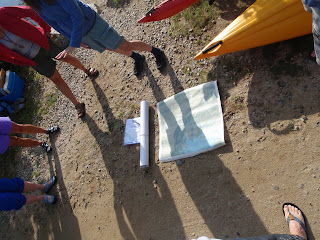
Early morning sun = long shadows.

I dragged the boys out of bed at the crack of dawn.  They willingly got dressed in return for the promise of Dunkin Donuts for breakfast on our way to Squam Lake.

It was COLD when we left the house.  It's been a LONG time since I saw 50F on a thermometer!

Thankfully, the sun was out and warmed things up quickly.  It warmed up to around 75F by the time we got out.  Plus, the water temperature was really nice.

We met up at a small public access point along a private road in the northwest side of Squam Lake.  The event organizer from LRCT laid out maps of the area and explained what properties are owned by the Trust and where we would be paddling.

This was 9 year old ES's third time using his Perception Acadia Scout kayak, and he did really well.

Right where we put in the water were some beautiful white water lily flowers.

The waterproof doodle pad was a big hit with both boys today.  Here my youngest son YB (6 years old) drew lily pads and flowers.

YB liked poking the lily pads as we smoothly glided through the water.

The Butterworth Preserve is accessible only by boat because it is surrounded by private property on the landward side.  However, there is a LRCT welcome kiosk with information about the preserve, and there is a well-marked walking trail to follow a loop around the preserve.

Ribbit!
Frog on the shore of the Butterworth Preserve

From the Butterworth Preserve, we paddled across Rattlesnake Cove and clockwise (south/southwest) around the Five Fingers peninsula at the base of East Rattlesnake Mountain.  We ended up stopping at a beach in the Five Fingers to stretch our legs and have a snack.

Pit Stop

Stretching our legs on a beach in the Five Fingers peninsula.

Croak!
 Toad on the shore in the Five Fingers area.

The boys took turns alternating between using the camera and using the waterproof doodle pad.  From the time that my eldest had the camera, I have lots of pictures of my back and the tow line between our two kayaks, plus some pretty nice self-portraits.

My Eldest Son's perspective

Like Father Like Son

Meanwhile, back in our boat, my youngest drew this picture of our adventure.  It's a kayaker with both ends of his paddle int he water.  Then he drew the sun and clouds in the sky.  Then he drew the trees on either side and birds sitting on the branches of the trees.

During the times that my youngest had the camera, I ended up with dozens of photos of the underside of the boat and the camera's floating strap dangling in the water.  

He also tried his own variation of the self-portrait.  He kept trying to hold the camera underwater and take a picture of himself up in the boat.

We saw one family of mergansers and a handful of pretty white birds diving into the water.  I think the diving birds might have been terns, but I couldn't tell from a distance.  

Toward the end of our trip, we passed a sign that gave me some hope we might see a loon.  

Sure enough, this majestic loon came paddling right by two of the kayaks in our group and kept diving below the surface. He didn't stay on the surface for very long, so I kept my camera pointed toward where I thought he might pop up in hopes of capturing a good picture.  He kept popping up in drastically different locations from what I expected though.

Here's the loon in between dives.  I was surprised how big he was.  I always thought they were probably about the same size as a duck.  You don't get the sense of it from this picture, but he seemed about twice as big as a mallard duck - more like the size of a goose or a swan.


Many thanks and kudos to Kristen from the Lakes Region Conservation Trust for organizing and leading us on this wonderful day on the water!  I am so glad the boys agreed to go with me on this trip.  After we got out of the water and were loading up the car, the boys made my day when, without prompting, they both told me that the had fun.

Stats for the paddle log:  (Note: The stats on Garmin Connect are inaccurate because I forgot to click "stop" on my Forerunner.  The Garmin Connect data includes the first stretch of road we drove in the car until my Forerunner beeped at me to tell me we had finished another mile.  Doh!  Quick!  Turn it off!)
  • Date: 21 August 2010
  • Time In: 8:39 a.m.
  • Time Out: 12:17 p.m.
  • Elapsed:  3 hours 38 minutes
  • Moving Time (GPS):  3 hrs 5 minutes 
  • Stopped Time (GPS):  33 minutes
  • Mileage: 5.1 miles by GPS
  • Sea State: 0
  • Winds: Negligible
  • Air Temp:  50F warming up to 75F
  • Water Temp: 75.8F digital
  • Current:  None.
  • Gauge Height:  Lake level is about a foot or two below normal.
  • Avg Speed (GPS):  1.7 mph
  • Max Speed by (GPS):  4.1 mph
  • Rapids?  None. 
  • Hazards?  None.
  • Kit: Ocean Kayak Malibu Two XL. Flop hat, NRS paddling gloves, short sleeve shirt, swim trunks, Keen sandals.  Because it was initially so cold in the morning, I brought my Kokotat jacket & NRS pants, and I brought the boys' rain pants and windbreakers, but we didn't end up needing them.
  • Configuration: 6 year old YB rode in the front seat and I rode in the middle seat of our Ocean Kayak Malibu Two XL.  9 year old ES rode in his own Perception Acadia Scout.
  • Route:  Put-in from a public access point along a private road in the northwest end of Squam Lake.  [Note: If you are reading this in Google Reader, then you will not see the Garmin Connect map here for some reason.  You actually have to come to my blog to see the map of where we went from the GPS.]   

  • Other comments (such as wildlife spotted): Mergansers, loon, frog, toad, diving birds (terns?).
Similar to when we finished our West Rattlesnake Mountain hike, we got in the car and I did a search in our car navigation system for the nearest restaurant.  Again, Walter's Basin in Holderness was still the closest.  However, Holderness wasn't exactly on the way back to home, so we started driving back toward Moultonborough and searching for something else.

We ended up stopping at the Corner House Inn in Sandwich, NH.  It seemed kinda fancy for us in swim trunks and t-shirts, but they had a pub upstairs and said we were welcome to have lunch there.  Lunch was AWESOME.  I just like saying, "I had an awesome sandwich in Sandwich."

    Saturday, August 28, 2010

    West Rattlesnake Mountain Hike


    While we're up at Lake Winnipesaukee on family vacation, the weather will periodically prevent us from going out on the lake.  For instance, when it's too windy and there are white caps on the lake, it's not worth going out in the boat, so we look for other places to go and things to do.  There are a LOT of great hikes to do around the lake region, at least - from what I hear.  I've been wanting to get out and do some of the local kid-friendly hikes.

    The first opportunity presented itself last Friday.  The boys and I headed over to the western side of Squam Lake to hike West Rattlesnake Mountain.  It's more like a large hill than a mountain per se, and it's a very kid-friendly hike.

    Parking Lot

    There are two small parking lots right on the road at the bottom of the trail that can accommodate about a dozen or so cars.  When we arrived at 10:30 a.m. on a Friday, there were only about three empty parking spots, and there was a steady flow of people both arriving and departing the parking lot.  Although we saw many people along the trail and at the summit, it was by no means crowded.

    The trail head is right at the end of the parking lot, and there is a welcome kiosk with a trail map and information about the hike.  The kiosk also served as a sort of lost-and-found.  There was a hat and a camelbak bottle that I assume someone found along the trail and left at the kiosk for the owner to retrieve.

    The trail is well-defined with a lot of man-made wood steps and gravel.  It is also well-marked with yellow trail blazes like in the photo above.

    There were some stretches of hard-pack dirt or natural stones and tree roots to step over.

    We arrived at what we thought was "the top" and spent some time there taking pictures.  

    ES admiring Squam Lake from West Rattlesnake Mountain

    The boys took turns taking pictures of each other.  I thought this series of pictures that my eldest son took of my youngest son were pretty funny:


    However, THIS was my favorite picture of the day:
    Self portrait with the boys overlooking Squam Lake.

    After we had taken a bunch of pictures, we decided to continue on and look for two geocaches on top of West Rattlesnake.  As it turns out, our first view point was NOT, in fact, the top.  When we got to the summit, I said, "wow."

    Panorama view from the top

    Here from this view point near the summit, there is an earthcache, then just over the top of the summit is an actual physical geocache.

    Found It!

    Heading back down the hill again, the boys got a little excited and went a little faster than they should.  We ended up with two skinned / bloody knees as a result.  So be careful and watch your step on your way back down the hill.

    Hike Stats:  When I'm searching for places to hike with my kids, I appreciate having some basic facts and figures about the hike for me to judge if it's doable with my kids.  With that in mind, I hope other parents considering this hike find the following information useful.
    • Date: 20 August 2010
    • Time of Departure: 10:30 a.m.
    • Time of Return: 12:39 p.m.
    • Elapsed:  2 hours 9 minutes
    • Moving Time (GPS):  1 hr 5 minutes 
    • Stopped Time (GPS):  1 hr 4 minutes 
    • Mileage (GPS): 2.3 miles (Note this includes a small extra hike over the hill to get a geocache and back.  If you don't go for the geocache, then it'll be shorter.)
    • Avg Speed (GPS):  2.1 mph
    • Elevation Gain:  443 feet
    • Max Elevation:  1245 feet
    • Weather:   Sunny but breezy.
    • Winds:  It was fairly calm walking up in the woods, but out on the view point it was pretty breezy.  According to NH Weather, it was 5-10 mph NNW.
    • Air Temp: 64F climbing to 67F (from NH Weather)
    • Trail:  Well-defined trail.  Hard pack dirt or gravel.  Man-made wood steps or natural stones.
    • Hazards?  Some steep drop-offs - keep on eye on your kids.
    • Kit: Regular sneakers.  We brought our walking sticks but didn't really need them.  We all wore shorts.  The boys started out wearing sweatshirts, but had taken them off by the time we were done.  I took a sweatshirt wrapped around my waist, but never needed it.
    • Route:  There is a pamphlet with a trail map available in pdf format here.  On the Garmin Connect map below, you can click on "terrain" to see the 3D relief / elevation.  Also, if you click on the "Hike West Rattlesnake Mountain" banner and go to the Garmin Connect site you can see the actual altitude profile of our hike.  
    • [Note: If you are reading this in Google Reader, then you will not see the Garmin Connect map here for some reason.  You actually have to come to my blog to see the map of where we went from the GPS.]


    After we got back in the car, I did a search in our car navigation system for the nearest restaurants to get lunch. The closest was Walter's Basin in Holderness, NH. I had recently heard that Walter's Basin was good, so we went to give it a try. It was a very nice place right on Squam Lake, and we had an excellent lunch there.

    Lunch at Walter's Basin