Thursday, July 28, 2011

Paddle Log #24: Port Gamble, WA

Back in Virginia, I normally followed the 120-rule for kayaking.  The 120-rule states that the air temperature plus the water temperature have to add up to at least 120F in order to go kayaking without cold weather gear like a wetsuit.  The 120-rule is generally satisfied from around May to September there.

Not here.

Looking at the historic water temperatures around here, it's typically in the 50s, so it requires some pretty warm air temperature (above 70) to meet the same 120 rule, and that doesn't seem to happen all that often, either.  I think maybe about a month from mid-July to mid-August.  I picked up a book about kayaking in the Pacific Northwest, and I noted in the introduction that they refer to the 100-rule.  Mmm-hmmm.

MWR here at Naval Base Kitsap (NBK) offers a lot of great outdoor activities.  Actually, I think they call it Fleet & Family Readiness (FFR) here.  Whenever I go kayaking someplace for the first time, I prefer to go with someone else who has been before and is familiar with the area and the hazards.  The Pacific Edge Outfitters on the Bangor Sub Base offers everything you could possibly need to rent for any outdoor recreation.  They also have regular organized trips, like a Wednesday night paddle.

That's another odd thing about Kitsap versus Virginia...  the time of sunset.  We're so far north in latitude here, it's 9:30 p.m. and I can still see orange sky above the Olympic Mountains out my family room window.  Combine that with the fact that the warmest time of the day tends to be in the late afternoon when the sun has burnt off the fog and clouds, and it makes for some pretty nice evening kayaking.

Last night, my boys and I went with the FFR Wednesday evening paddle to Port Gamble.  Each of these Wednesday night paddles have met up at Pacific Edge Outfitters at 5 p.m. and plan to be back to Pacific Edge around 9 p.m.  We met up there and caravaned up to Salsbury Point Park just north of the Hood Canal Bridge.

Suit up!  On the beach at Salsbury Point Park
getting ready to head out onto Hood Canal.

This was the first time kayaking for the boys this year.  I was glad that my younger son's rain pants still fit.  My eldest son has outgrown his rain pants, but his kayak has a lip that is able to use a kayak skirt, so we used one of the kayak skirts from Pacific Edge Outfitters.  It did a great job keeping the water out of ES's cockpit and he was very pleased to stay dry and comfortable from start to finish. 


YB seemed dry and comfortable for the duration of the evening, too.

Paddling on Hood Canal north of the bridge.
(Hood Head in the background)

From Salsbury Point Park, we paddled east along the shore past the small town of Port Gamble and around the old lumber mill.  The Port Gamble Sawmill was the oldest mill in the country when it closed down in 1995.

We had a very nice paddle around the sawmill and back.  We saw one bald eagle on top of the sawmill, a couple of bluejays and guillemot pigeons, plus 3 harbor seals.  We looked for a family of otters that supposedly live to the south of the sawmill, but we didn't see any.

My youngest son took this photo of the bald eagle on top of the sawmill.

Heading back toward the Hood Canal Bridge.
 Brrr.

Stats for the paddle log:
  • Date: 27 July 2011
  • Time In: 6:03 p.m.
  • Time Out: Approx 8:09 p.m.
  • Elapsed:  2 hrs 6 min
  • Moving Time (GPS): 1 hour 56 min
  • Stopped Time (GPS):  10 min
  • Mileage (GPS): 4.28 miles
  • Sea State: 1
  • Winds: 5-10 kts NW
  • Air Temp:  68F dropping to 62F
  • Water Temp: 60F
  • Current:  Slack water at beginning, rising to 0.4 kt flood current at 1900.
  • Gauge Height:  N/A.
  • Avg Speed (GPS):  2.2 mph
  • Max Speed by (GPS):  5.0 mph
  • Rapids?  None. 
  • Hazards?  Wake from passing boats, chop from the wind.
  • Kit: Ocean Kayak Malibu Two XL (my youngest son and I), Perception Acadia Scout (eldest son).  Ballcap, NRS paddling gloves, short sleeve shirt, NRS paddling pants, neoprene booties.  Youngest son wore his rain pants and NRS neoprene socks.  Eldest son had outgrown his rain pants from last year.  He wore swim trunks and his NRS neoprene socks, but he used a skirt from Pacific Edge Outfitters and it kept him dry.  He complained he was getting cold about half way through, so he put on his jacket.  I brought both boys' jackets in the center storage compartment of my kayak.
  • Configuration: YB in front, me in the middle seat.  ES in his own kayak.
  • Route:  Put-in at Salsbury Point Park, east around Port Gamble and back (see Garmin Connect below).
  • Other comments (such as wildlife spotted): Bald eagle, blue jays, guillemot pigeons, seagulls, 3 harbor seals.

Wednesday, July 6, 2011

Guillemot Cove Nature Reserve

This post is a little delayed.  I've been a bit busy with my family arriving from Virginia, moving into a new house, having our household goods (HHG) delivered, and trying to dig ourselves out of the sea of cardboard boxes.

The weekend before my family arrived, I went for a very nice walk through the Guillemot Cove Nature Reserve.  Sitting here now, looking at that website for the nature reserve, the photos don't look very exciting, and I probably wouldn't have gone out of my way to go there.  Actually, I ended up there sort of by accident, but I'm very glad I did.

In searching for a new park to explore, I was just scrolling around Google Maps looking at the green spots that represent a park of some sort.  I noticed Stavis Creek and read a bit on the web about the wildlife that can be seen in this park, so I actually went in search of Stavis Creek.  I tried to get at it from a couple of different approaches, but I kept running into private property and no trespassing signs and turning away.  It didn't bother me though, because I was enjoying the drive around the countryside.  I ended up driving by the Guillemot Cove Nature Reserve sign purely by accident.  I needed to get out and stretch my legs, so I stopped to check it out.  (Post Facto Comment:  I eventually found out how to get into Stavis Creek, but it wasn't until after I had finished my walk in Guillmot Cove and it was way past time for lunch.)


The trails are well-defined and easy to follow.  There are a couple of trails to choose from, but they all lead down to the cove.  Unfortunately, you don't get a trail map until you get to the bottom.

Down at the bottom of the hill near the actual cove, there is an information kiosk with a map of the property and the trails.

At the bottom of the hill, I discovered the trail to the cove itself was washed out, and I wasn't wearing shoes for trudging through the marshy bog.  Even so, there are a couple of loop trails going off into the woods along a gurgling stream.

There's an old abandoned house and barn at the bottom of the hill.  There are signs posted on the barn that the structure isn't safe for entry.

During my walk through the nature reserve, I heard beautiful bird songs that were unfamiliar to me.  The birds I saw were too fast for my camera, and I'm not very good at identifying them.  The only one I readily recognized was a beautiful red-headed woodpecker.

There were flowers of every shape and color imaginable.  Everywhere I turned, there were beautiful pink rhododendrons in bloom, plus an abundance of little yellow buttercups closer to the ground. 

I kept seeing these berries, and I wasn't sure what they were.

Then I saw this flower and remembered looking up the name of the flower after my Green Mountain hike, and it was called salmonberry.

Ahhhh, it all makes sense now!  Salmonberry!

This one was new to me - American Starflower (Trientalis borealis).

This was also new to me - Nootka Rose (rosa nutkana).


This was the first time I had seen Foxglove.  Since then, I've seen it along the side of the road just about everywhere I go.


There were some beautiful mushrooms and fungi growing here and there along the trail, too.


On my way back to the information kiosk and the trail back up to the parking lot, I rounded a bend in the trail, and I'm not sure who was more startled...
...me or the deer.  

The deer didn't seem to mind me after the initial surprise.  She continued to munch on the grass and slowly walk ahead of me down the trail. 

Trip stats from the Garmin.
(2.7 miles walked, 1 hour moving, 42 min stopped)

It was a very enjoyable walk through the nature reserve, so I was in no hurry.  By the time I got back to my car it was well after 1 p.m. and I hadn't had lunch yet.  There isn't much between there and Silverdale except for my new favorite restaurant on the peninsula - Barbie's Cafe in Seabeck, so it was an easy decision to stop there for some of their kickin' crab chowder (crab and corn chowder with jalapenos) for lunch on my way back.

Sunday, July 3, 2011

Kitsap Kayaking Resources

From my experience in Virginia, I was always doing the same Google searches and going back to visit the same websites to get data for planning kayaking excursions, so I wrote my Virginia Kayaking Resources post as a quick reference for me and anyone else who is looking for certain data for planning.  Now that I'm living on the Kitsap peninsula in the great state of Washington, I haven't found any pre-existing quick-reference list of links, so I'm going to create one here.

I will periodically come back and update this post with new links as I find more useful websites.

Water TEMP:
- National Estuarine Research Reserve System:  Environmental monitoring buoys at Hoodsport, Twanoh, and Dabob Bay
- NOAA:  Port Townshend

Water LEVEL (Tides or Gage Heights):
- Saltwatertides.com:  Table format only, but for whatever date range you desires
- WSDOT Hood Canal Bridge:  Graphic format for next 24 hours
- National Weather Service:  Gage heights for rivers

Water CURRENT:
- NOAA Tidal Current Tables

Sunrise / Sunset:
- Wunderground Silverdale

Routes / Maps:
- Washington State Park maps.
- WDFW Water Access sites.
* * *  Don't forget your Discover Pass. * * *  As of 7/1/2011, you must have a Discover Pass to park at / use Washington State Parks.  You can purchase either a 1-day pass for $10 or an annual pass for $35.  If you buy one online, then they will email you a temporary pass you can print out and put on your dashboard until your permanent pass comes in the mail. 
- North Kitsap Trails Association string of pearls map
- Kitsap Water Trails map
- Paddle Kitsap route map
- Mason County recreation map (South of Kitsap - down around Belfair and Allyn off Rt. 3)

- Paddling.net under the "Go Paddling" pull-down menu, select "Places to Paddle" and then "Virginia Washington."  They have both an alphabetical list of place names and a GIS map showing verified and unverified water access points.


CLUBS:
- Olympic Kayak Club
- Paddle Kitsap is an organized two day event that paddles around the Kitsap Peninsula in August.

GUIDES / OUTFITTERS:
- Pacific Edge Outfitters on Naval Base Kitsap (for military folks).  I have not yet rented any kayaking gear there, but the staff was VERY friendly and helpful when I went to rent snowshoes and snowpants for hiking on Mount Ranier in the winter.  They DO rent kayaks and just about any other outdoor activity gear you could possibly want.
- Navy MWR offers organized paddling trips such as Wednesday evening paddles (5-9 p.m. about once a month) and the Paddle-Pedal-Pack excursion (4 mile paddle, 10 mile bike ride, 2 mile hike).  Search for these under "TRIPS" on their menu.  Searching under "ACTIVITIES" will only return classes.  
- Jackie's Marine & Kayak at the Brownsville Marina. Searched BBB and Yelp, found no results.
- Kayak Brinnon.  This is across Hood Canal over by Dabob Bay.  I hope to do their naturalist-guided paddle in the Dosewallips Estuary sometime.  Searched BBB and Yelp, found no results.
- Olympic Raft and Kayak.  I hope to go on one of their guided paddle trips before we leave the area.

BOOKS:

- Kayaking Puget Sound, the San Juans, and Gulf Islands.
- Kayak Routes of the Pacific Northwest Coast
- Paddling Washington: 100 Flatwater and Whitewater Routes in Washington State and the Inland Northwest
Sunday, June 26, 2011

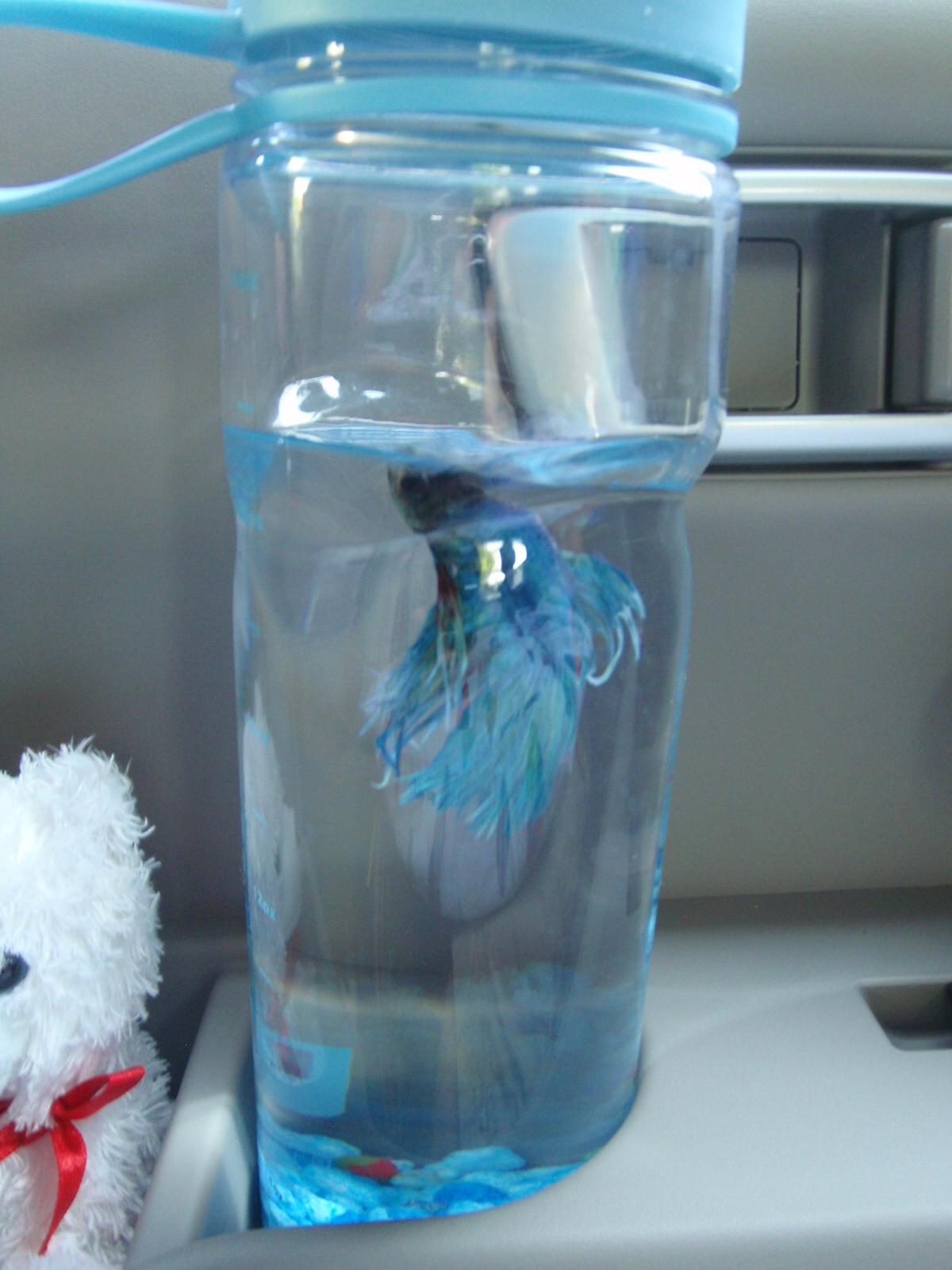
But alas poor Smokey...

We are mourning the loss of a family member today.


Smokey was a good fish. 


Loyal.

Friendly.

Resilient.

Okay, so "loyal" may be stretching it a bit.  It's not like he had a choice who his owners were.  However, he was definitely a friendly and resilient fish.

I never thought fish responded to people or showed any sign of personality before we got Smokey.  He actually came out of his little fish-bowl house and appeared to wag his tail for us when we would walk into the room. 

He was certainly a well-traveled fish, having made the trip to New Hampshire for summer vacation and most recently the 3,000 mile drive across country from Virginia to Washington.  He proved his resilience more than once.  The first occasion earned a Post-of-the-Week award for his tumble down the stairs

Smokey's Travel Fish-bowl

The most recent occasion I now realize I forgot to write about.  It was when we went on vacation in New Hampshire last summer.  The boys and I had recently watched What About Bob, and they got the idea of taking Smokey with us in a glass jar like Bill Murray with his pet fish Gill.  In anticipation of our upcoming PCS transfer to Washington, we decided to use the drive to NH as a test run for Smokey.  He passed with flying colors. 

Well... swimming colors I suppose. 

There was a close call along the way though.  When we stopped to tour the Valley Forge National Historic Park, we left Smokey in the car. 

It got a little warm.

When we returned to the car, we found Smokey on floating on his side near the top of his water jug, periodically twitching one of his fins like a toy whose batteries were worn out.  We manned battlestations-fish-resuscitation, cranked on the A/C and my wonderful wife held Smokey's jar in front of the vent to cool him off (but not so quickly as to put him in thermal shock).  He seemed just fine a couple of hours later.  No harm done apparently.

I suppose I didn't write about it so none of you would be calling the humane society on me for leaving a pet unattended in the car.

Along the way across country this month, he got to visit the Louisville Slugger bat factory, Mount Rushmore, and Yellowstone National Park.  In hindsight, I am wishing we had taken pictures of him at all those places.

Well, Smokey has gone to to the big fishbowl in the sky now.  This is a first time for my kids to deal with death first hand.  My eldest son (ES) seems to be taking it harder than my younger son. 

We asked the boys what they would like to do for a funeral for Smokey.  We offered the burial-at-sea-via-the-toilet or the bury-in-the-back-yard options.  ES didn't want either.  The toilet seemed to undignified, and he said Smokey wouldn't want to be buried in Washington because he's a Virginia fish.  We convinced the boys we should bury him here at our new home in Washington.

Actually, in order to calm ES down, my wife told him we would exhume Smokey when we leave Washington in a few years and head back to the east coast, and take him back to VA for a proper burial.

...Being a Virginia fish and all.

We're hoping ES forgets by then.


It was a spectacularly gorgeous day in Washington.  Here my wife and son dig a grave for Smokey in our back yard.


So long, Smokey.  You will be missed.

Thursday, June 9, 2011

DC Gouge: New Submarine Exhibit Opening at Navy Museum

If you're in DC and you've never been to the Navy Museum at the Washington Navy Yard, then I highly recommend checking it out.

My youngest son on the periscope in the Navy Museum

Soon there will be even more cool stuff to see at the museum.  I just received this from the DC Naval Submarine League:

The submarine exhibit “Covert Submarine Operations” will be dedicated by the Naval Historical Foundation on Saturday, 18 June at the Washington Navy Yard Museum.  The event is open to all connected with the Submarine Force and Naval Submarine League.  The attached invitation (email me if you want a copy of the invite) provides the details and a map of the WNY with directions to the Cold War Gallery museum.  Spouse/friends are included in the invitation.

(Event is past - so I removed the RSVP data)

The exhibit contains most of the artifacts from the Smithsonian’s “Fast Attack and Boomers” exhibit that was opened in 2000 as part of the Submarine Force Centennial celebration and is the first major exhibit in the Museum’s new Cold War Gallery.

If I were still in DC, then I know where I would be going next Saturday! 

Sunday, June 5, 2011

Olympic National Park - Hurricane Ridge Hike

It was a spectacularly beautiful weekend here in the Pacific Northwest.  I decided to get another use out of my National Park annual pass that expires this month and head over to check out Olympic National Park

When I sat down at my computer to do some research and figure out when and where to go, I was amazed by the size of the park.  It's bigger than the state of Rhode Island for cryin' out loud (777,000 acres in RI vs. 922,000 acres in ONP).  There are several different visitor centers at different places around the park.  I get the impression that each one is strategically located to show a very different aspect of the park - sub-alpine versus rain forest versus coastal). 

I decided to try Hurricane Ridge, at the Northern end of the park, about twenty miles south of Port Angeles, Washington.  I could tell from the webcam that there is still snow up there (there's a second webcam on the parking lot), but I couldn't find any useful gouge on whether I would need snowshoes or not.  The thought of renting snowshoes at Pacific Edge Outfitters again crossed my mind, but I remembered that the National Park visitor center on Mt. Rainier offered snow shoes for rent there.  The ONP website said they had snowshoes to rent, so I figured I would drive up there and rent them if I needed them. 

Scenery on the drive up from Port Angeles

Scenery on the drive up from Port Angeles

There was just a little bit of snow left over from "winter."

Well, come to find out, there are basically two seasons at Hurricane Ridge.  During the winter season, they rent skis, sleds, snowshoes, and run a ski lift and have a big booming business.  They even have park ranger led showshoe hikes.  The "winter" season ends around mid March.  Next, the "summer" season seems to start around mid July, and there are park ranger led hikes to admire beautiful flowers and stunning views. 

Apparently though, if you go in between the end of "winter" and the beginning of "summer" then you pretty much get to make do on your own.  Nothing is available to rent.  No park rangers provide any guided hikes.  It's all you.

Don't get me wrong.  I had a great time, and I'm very glad I went.  I was just surprised by the gap in activity offered at this park compared to most other national parks. 

I had lunch in the visitor center cafe, and it was very good.  Much better than the cafe at Mt. Rainier.  I had a ham and swiss on rye with sweet potato fries and it was delicious.

This was the view I got to enjoy from the cafe while eating my lunch.  Nope, no need to rent any showshoes or anything like that this time of year.

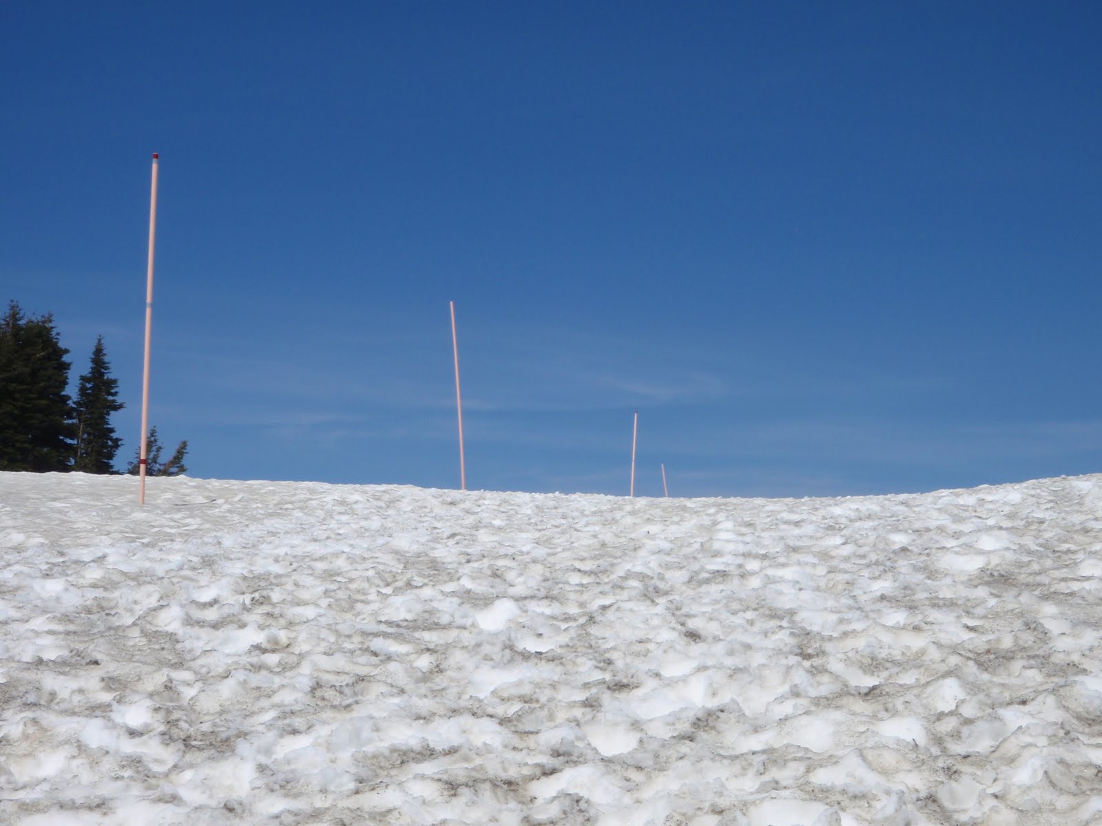
The park ranger at the visitor center told me they put out orange poles in the snow leading away from the parking lot to lead people to a scenic overlook.  She told me the snow was packed down enough that I didn't need snowshoes. 

Sure enough.

Oh, but don't walk past the LAST orange pole.

The view was indeed spectacular.  The photo doesn't do it justice.  In the foreground is Port Angeles, then the Strait of Juan de Fuca, then Victoria, British Columbia in the distance.

Obligatory Blunoz self-portrait

I hiked clockwise around the ridge.  This is looking back at where those avalanche warning signs were.

See the signs?

Aside from walking the short distance along the orange poles from the visitor center to the view point, most people were just walking the plowed Hurricane Ridge Road.  It was closed to vehicles and partially plowed, and it wound back and forth down the hill for a mile or so.  The view was much better from up on top of the snow on either side of the road than it was from on the pavement.  Since it was my first time there and I didn't have snowshoes or skis, I stayed close to the paved road.  I did see some people showing up with their own snowshoes go trekking off into the snow though, and it made me wish I had my own.  

For the portion of my hike that I did on the road, I kept thinking I was Luke Skywalker attacking the Death Star.  Then I came to the end of where the plow had been...
Use the Force, Luke!

After crossing over to the south side of the road, I found an area where the snow had melted.

Over on this side of the ridge, I had several of these pretty birds following me along from tree to tree.  I don't know if they were just naturally curious or if they've been fed by humans one too many times and were looking for a handout.

Overall, it was a gorgeous day, a very enjoyable drive, and a nice hike with stunning scenery.  This will certainly not be my last time to visit ONP.  Next time I'll just have to bring my own snowshoes, or come back in the summer season when the snow has melted.

Trip Stats on the GPS
Hike Stats:
Date: 4 June 2011
Start Time:  12:43 p.m.
Moving Time Elapsed:  1 hr 43 min
Stopped Time Elapsed:  30 min
Finish Time:  2:55 p.m.
Miles:  3.1 miles
Elevation gain: 443 feet
Temp:  Began approx 57F climbing to 64F when I drove back down.
Wind:  None.